Monday, December 10, 2007
Alta has snow.
Well, Alta finally got one of its trademark storms, and we were left with around 3 feet of fresh, fluffy powder that fell from friday to sunday morning. Too bad it was a weekend storm- the place was crawling with people roaming the mountain, devouring the powder. Things have picked up here at the Peruvian too, and I've been working in the kitchen a good bit lately. My writing has been coming along too, and I've been producing some good work.
Friday, November 30, 2007
Opening Day
It's opening day at Alta and Snowbird, I've got the day off, a big snowstorm is coming in, and I lost my pass! Starting the season off exactly the wrong way. Looks like I'll be spending forty bucks I don't have to get a new one.
It's bitterly ironic that Saint Anthony is the patron saint of lost things.
dammit.
It's bitterly ironic that Saint Anthony is the patron saint of lost things.
dammit.
Saturday, November 10, 2007
My arrival in Utah: Pre-snow
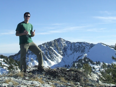
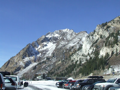
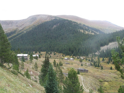
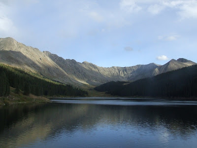
After three long days of driving, I finally arrived at the Alta Peruvian Lodge to begin my winter job. The season doesn't open until the 15th, and the snow cover is pretty spotty, so the main occupation at the involves socializing with the other employees (there are about 25 here so far) and taking hikes around the area to scope out ski spots. I've yet to start working in the kitchen, but there should be some work for me in the coming days. The scene here at the APL is very relaxed, and pretty much everyone is laid-back and easy to get along with. However, there is a strong undercurrent of tension since everyone has been talking about skiing and riding, talking about their gear, watching ski movies, and pretty much everything else aside from actually skiing. There is a cold front moving in that will hopefully bring some new snow in the coming days, so we'll see what happens.
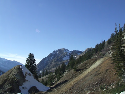
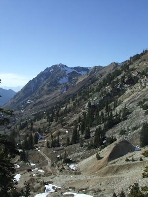
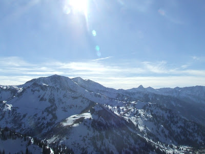
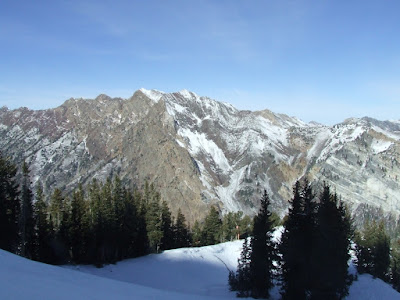
Here are some pictures from a hike we took the other day:
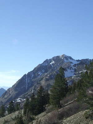
Mt. Superior
A huge gap jump in the foreground, Mt, Superior in the background
looking up towards Wolverine
Alta with just a bit of snow
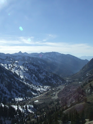
the Alta base area
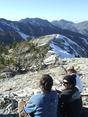
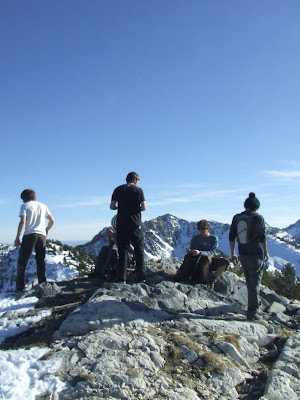
the group at the top of Grizzly
I like snow.
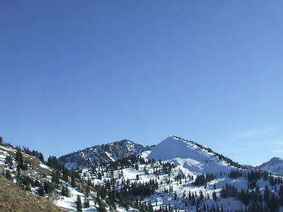
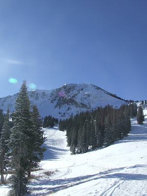
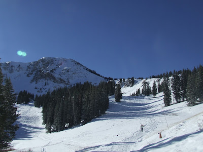
On sunday we received a few inches of dense snow, so today a bunch of us hiked up the shoulder of Baldy to take some turns. It was surprisingly good skiing, and although I was scared of destroying my skis on a rock, it didn't happen.
Hiking up to Baldy
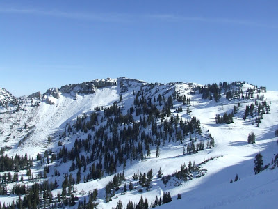
High Sunspot across the bowl
a frosty Mt. Superior
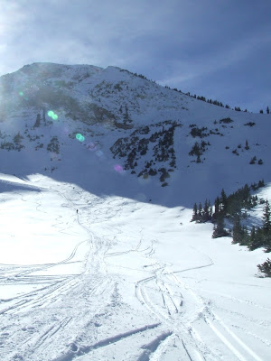
Baldy after riding down
The Alta Peruvian Lodge (left) and our dorm (right) dwarfed by Superior
Here are some pictures from a hike we took the other day:
Mt. Superior
A huge gap jump in the foreground, Mt, Superior in the background
looking up towards Wolverine
Alta with just a bit of snow
the Alta base area
the group at the top of Grizzly
I like snow.
On sunday we received a few inches of dense snow, so today a bunch of us hiked up the shoulder of Baldy to take some turns. It was surprisingly good skiing, and although I was scared of destroying my skis on a rock, it didn't happen.
Hiking up to Baldy
High Sunspot across the bowl
a frosty Mt. Superior
Baldy after riding down
The Alta Peruvian Lodge (left) and our dorm (right) dwarfed by Superior
Monday, October 15, 2007
After the fact: contemplating a book
Now that my summer of travelling has well and truly ended, I'm left here in Vermont for a few weeks before the car trip out to Utah. Numerous friends and family have complimented me on my writing in the blog, and I have been thinking about writing some articles, poems, and maybe compiling a book about the experiences I've had on the road.
This would be a pretty big step for me as a writer, since I haven't ever written anything more substantial than term papers in the last few years. I've determined to approach the writing task with a similar approach as I did the bike tour: tell a bunch of people about the wild plan I have to do some huge and daunting task, which leaves me no choice but to go ahead and do it, if for no greater reason than to keep my word.
Since I'll be spending my winter at the Alta ski resort, which provides little in the way of off-hour entertainment (aside from skiing) I've decided to take this opportunity to jump headfirst into my writing. Watch this space to find out where you can find my material. Even if this stuff never gets published, and I never make a cent, watch this space for poems, stories, and articles about the bike tour and my time in Utah.
PS- As of last week, Alta had a foot of new snow! ha!
Also, if you want to come out here and visit me and sample the best snow in the world, don't hesitate to drop everything and get the hell out there!
Thursday, September 20, 2007
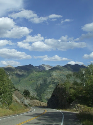
Colorado: Lots of large mountains
Hey, since I got the job at Alta, I decided to take a winding route through the Rockies and ride up some mountains! From Gunnison I took Highway 92, which hugs the Cuercanti Creek Canyon and the Morrow Point Reservoir. Lots of great curves, rock formations, aspen groves and views of the water below. This would be an excellent motorcycling road (mom and dad, wink wink.)
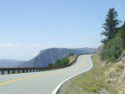
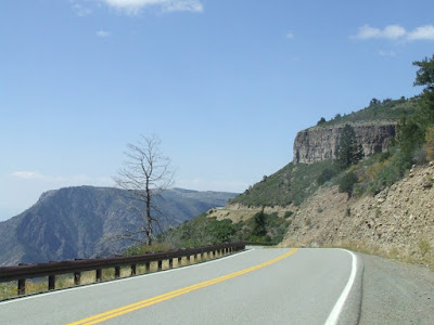
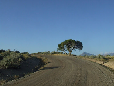
From there I descended into a drier, more desert-like landscape as I continued north.
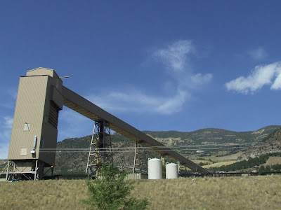
I then climbed up through several mining towns, where conveyor belts of coal churned out from the hillside. I was tempted to swim in the river running paralell to the road but there always seemed to be a coal mine upstream from where I was.
I continued uphill to summit McClure pass. Although it's 'only' at 8755ft, it was a pretty long and difficult climb that wore me out.
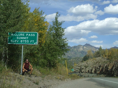
But as usual, the view from the top of a mountain pass makes up for the pain of the climb.
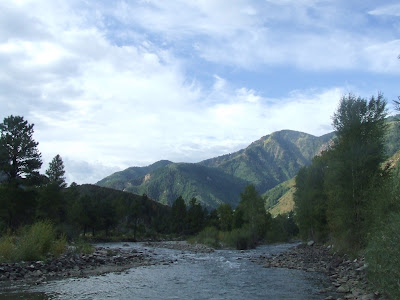
The road down the other side of McClure Pass was quintissential Colorado- riding through a narrow river valley surrounded by high rock walls. The river looked ripe for fly fishing, and on my morning descent I saw a few guys taking casts.
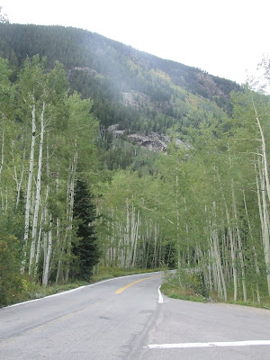
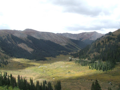
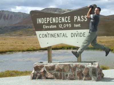
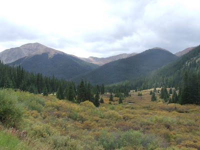
My next destination was Independence Pass, which climbs up from Aspen to a height of over 12,000 feet. Narrow, cliff-hugging sections of road, river gorges, pine trees, and (duh) aspen trees made this easily the best, most scenic ride of the tour. In several places the road is chiseled from the side of a cliff and the road is scarcely one lane wide. Since the pass makes the shortest connection between Aspen and the Leadville area, there is a ton of car traffic that travels the pass. Fortunately the road is so narrow that people are forced to drive slowly.
Before I forget- thanks Bruce from the Aspen area, who saw me looking confused on the roadside and stopped his truck to give me advice on the road to Independence Pass. Bruce has ridden cross-country before and we discussed the overwhelming hospitality to be found in the midwest, among other things.
Anyway, here's a small sampling of what Independence pass has to offer:
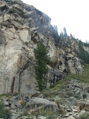
They're barely visible at this size, but there are people climbing this cliff. If you can spot the belayers at the bottom right side of the rock wall (where the rock has black streaks running down it,) it gives you a good feel for how big this wall is.
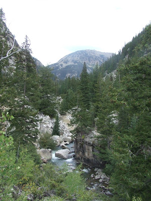
Independence has several National Forest campgrounds at a pretty high altitude, and I spent the night at the well-named Lost Man campground, only a few miles from the top of the pass. If you're looking for a good place to spend the night up there, I highly recommend it, as its in the midst of a beautiful alpine forest and many of the campsites are right on the bank of the river.
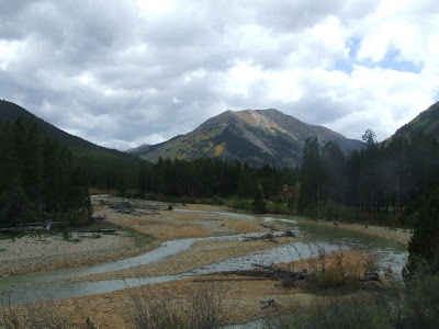
The next morning I made for the summit of Independence Pass, and nestled in the top of the river valley is the ghost town of Independence, which at one time mined for gold. Apparently there were year-round residents, which is pretty staggering considering it was located at around 11,000 feet in sight of the top of the pass.
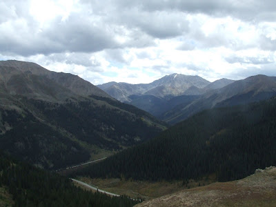
As I continued toward the top of the pass, the view looking down the valley was spectacular and ever-changing due to the scattered clouds which intermittantly cast the landscape in light and shadow.
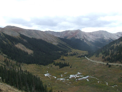
Those silver squiggles in the above picture are the headwaters of the river that flows all the way down the valley to Aspen.
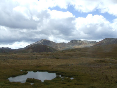
The top of the pass was a great example of high alpine tundra, and the landscape was stark and very windy.
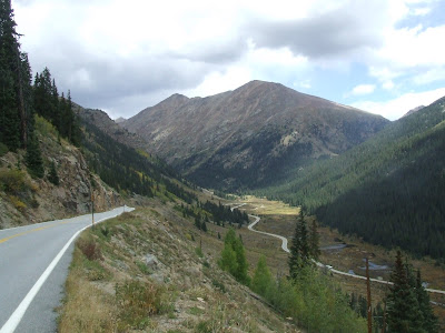
The descent from Independence was epic. Lots of steep grades, hairpin turns and awesome scenery that went on for miles.
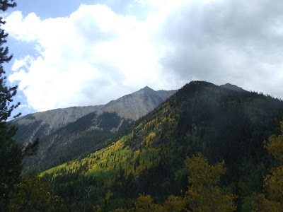
I should also note that mid-September is the height of autumn in the high mountains here, and all of the brush and deciduous trees were turning colors.
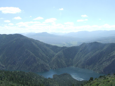
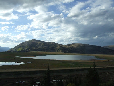
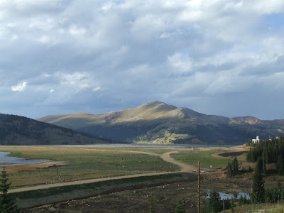
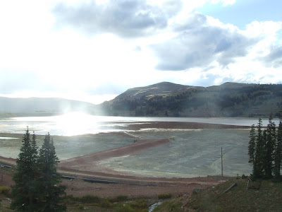
The next pass on my list was Fremont pass, and it was a definite change from the mostly unspoiled beauty of Independence. There's a molybdinum mine on the top of Fremont, and the valley at the top of the pass has been filled in by tailings (debris pulled out of the mine) and runoff. A sobering look at the industry by which much of Colorado was settled and developed.
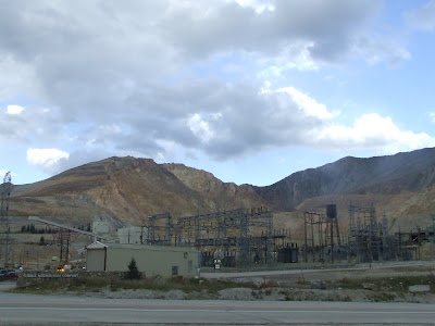
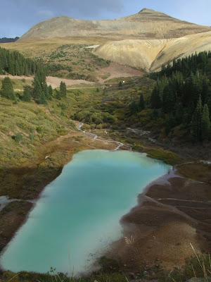
That pretty blue pool is runoff from the mine, and the yellow mound on the side of the mountain is a pile of tailings pulled from below the surface.
This pristine-looking body of water is on the other side of the road from the tailing fields and is a reservoir that is likely used as a water supply for the mine.
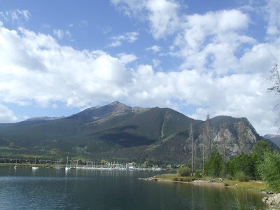
After descending Fremont, I was left at the foot of the Copper Mountain resort, right off of Interstate 70. My goal for the day was to get to the town of Frisco, where I hoped to deliver a wallet I had found in the middle of nowhere in Wyoming. I figured I should do a good deed by returning the wallet to start paying back the large karmic debt I owed to the people who have helped me along the road.
After hitchhiking to Frisco (I-70 is the only road from Copper to Frisco) I went to what I thought was the home of Robert Dunahugh, the owner of the wallet I found. After leaving a note on the door of what I assumed to be his house, I had nothing to do but wait for him to find the note and give me a phone call. Since it was Saturday night, I knew the best way to kill some time was to go out and sample the local nightlife. I ended up choosing the Moose Jaw, a local bar with a very casual and relaxed feel. After a drink or two, I pulled out the wallet and called over the bartender, handing him the driver's license from the wallet. He took one look at it and said "Sure, I know Bob! Where did you find this again?"
I told him, and he laughed and called to the waiter if he knew Bob's phone number. This whole exchange picqued the interest of several other people, and eventually one guy rushed off to go find Bob. A few minutes later, he returned with Bob Dunahugh, the owner of the wallet. We immediately struck up a conversation, and he bought me a drink with the money from his lost wallet. Apparently, he was riding his Buell motorcycle home from the Sturgis motorcycle rally back in early August when the wallet fell out of his jacket.
I also learned that Bob was a former road bike racer, and had done a fair bit of bike touring, including a European tour with his daughter. Since he is a native Coloradan and an avid biker, he told me about some good places to ride on the way back to Boulder.
Overall, I'm really glad I happened to find the wallet, and meeting Bob was a great addition to my trip. It feels great that through a serendipitous turn of events I was able to help someone out who happened to be a bike tourist as well.
Frisco from the end of the Reservoir at the edge of town.
From Frisco I headed up past several ski resorts, including Keystone and Arapahoe Basin, on the road to Loveland Pass. Loveland was yet another great pass with some great views.
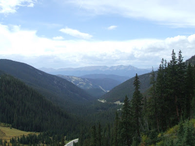
The view down the valley from Arapahoe Basin.
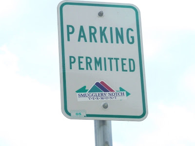
I spied this sticker at Arapahoe Basin. Apparently a Smuggs skier had to represent some hometown pride while skiing in Colorado. Awesome.
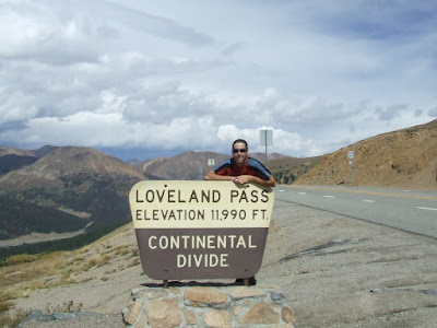
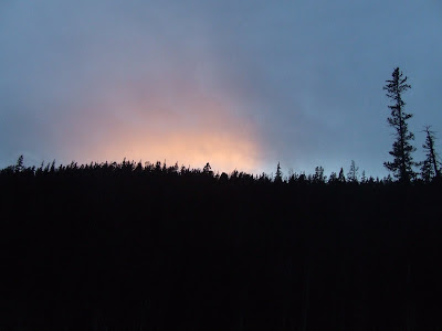
Standard "Top of the Pass" picture. You can see the storm fronts in the background that were rapidly moving in on me.
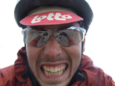
Getting my game face on as I prepared for the cold descent from Loveland Pass.
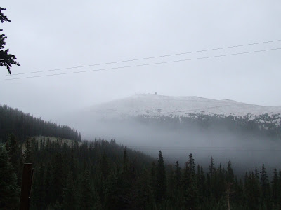
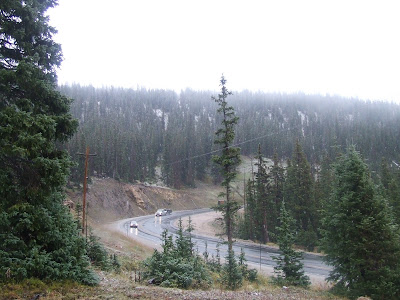
Next up on the hit parade was Berthoud Pass, which required a slightly (very) hairy ride on I-70, which at several points is the only through way going east-west. Once I left the Four Lane Death Zone, I rode through the rapidly fading light toward the pass, figuring I could get over it before nighfall.
Unfortunately, my map didn't show the eight massive switchbacks that I had to climb, and I consequently ran out of light and energy before the top of the pass. I ended up camping near a trailhead close to the top, and fell asleep quickly, exhausted.
It rained intermittantly through the night, and by morning it had changed to a frigid and pelting sleet. In the process of breaking down my tent and getting my things together, my shoes and gloves soaked through and my tent became saturated. The temperature continued to drop to below freezing, and the precipitation changed to snow. So at 10,000 feet, with soaked gear and extremities, I made the executive
decision to head to lower elevations.
I tried riding down, but the stinging snow and the cold were too much for me to bear. So I ended up sticking out my thumb, scoring a ride all the way to Golden, on the outskirts of Denver. From there, I decided to ride to Boulder to stay with my friends Chelsea and Dan until my flight back to Vermont.
I know that some people would criticize me for turning back, and not toughing out the weather, but at that point I figured that I wasn't enough of a masochist to finish out my trip with soaking wet gear. I guess I'm not the toughest tough guy.
So I ended up riding to Boulder, where the weather was about 75 degrees and beautiful. It's crazy the amount of variance in weather that can be found out here depending on the location and elevation.
The Flatirons, the mountain range which Boulder is at the foot of.
So that's it folks, the end of the tour for now. Look here in the upcoming months for epic skiing pics from Alta, Utah and future adventures. Feel free to email me if you like, and check out the link to my online photo albums from the bike tour. There are many more pictures there that I haven't posted on my blog.
From there I descended into a drier, more desert-like landscape as I continued north.
I then climbed up through several mining towns, where conveyor belts of coal churned out from the hillside. I was tempted to swim in the river running paralell to the road but there always seemed to be a coal mine upstream from where I was.
I continued uphill to summit McClure pass. Although it's 'only' at 8755ft, it was a pretty long and difficult climb that wore me out.
But as usual, the view from the top of a mountain pass makes up for the pain of the climb.
The road down the other side of McClure Pass was quintissential Colorado- riding through a narrow river valley surrounded by high rock walls. The river looked ripe for fly fishing, and on my morning descent I saw a few guys taking casts.
My next destination was Independence Pass, which climbs up from Aspen to a height of over 12,000 feet. Narrow, cliff-hugging sections of road, river gorges, pine trees, and (duh) aspen trees made this easily the best, most scenic ride of the tour. In several places the road is chiseled from the side of a cliff and the road is scarcely one lane wide. Since the pass makes the shortest connection between Aspen and the Leadville area, there is a ton of car traffic that travels the pass. Fortunately the road is so narrow that people are forced to drive slowly.
Before I forget- thanks Bruce from the Aspen area, who saw me looking confused on the roadside and stopped his truck to give me advice on the road to Independence Pass. Bruce has ridden cross-country before and we discussed the overwhelming hospitality to be found in the midwest, among other things.
Anyway, here's a small sampling of what Independence pass has to offer:
They're barely visible at this size, but there are people climbing this cliff. If you can spot the belayers at the bottom right side of the rock wall (where the rock has black streaks running down it,) it gives you a good feel for how big this wall is.
Independence has several National Forest campgrounds at a pretty high altitude, and I spent the night at the well-named Lost Man campground, only a few miles from the top of the pass. If you're looking for a good place to spend the night up there, I highly recommend it, as its in the midst of a beautiful alpine forest and many of the campsites are right on the bank of the river.
The next morning I made for the summit of Independence Pass, and nestled in the top of the river valley is the ghost town of Independence, which at one time mined for gold. Apparently there were year-round residents, which is pretty staggering considering it was located at around 11,000 feet in sight of the top of the pass.
As I continued toward the top of the pass, the view looking down the valley was spectacular and ever-changing due to the scattered clouds which intermittantly cast the landscape in light and shadow.
Those silver squiggles in the above picture are the headwaters of the river that flows all the way down the valley to Aspen.
The top of the pass was a great example of high alpine tundra, and the landscape was stark and very windy.
The descent from Independence was epic. Lots of steep grades, hairpin turns and awesome scenery that went on for miles.
I should also note that mid-September is the height of autumn in the high mountains here, and all of the brush and deciduous trees were turning colors.
The next pass on my list was Fremont pass, and it was a definite change from the mostly unspoiled beauty of Independence. There's a molybdinum mine on the top of Fremont, and the valley at the top of the pass has been filled in by tailings (debris pulled out of the mine) and runoff. A sobering look at the industry by which much of Colorado was settled and developed.
That pretty blue pool is runoff from the mine, and the yellow mound on the side of the mountain is a pile of tailings pulled from below the surface.
This pristine-looking body of water is on the other side of the road from the tailing fields and is a reservoir that is likely used as a water supply for the mine.
After descending Fremont, I was left at the foot of the Copper Mountain resort, right off of Interstate 70. My goal for the day was to get to the town of Frisco, where I hoped to deliver a wallet I had found in the middle of nowhere in Wyoming. I figured I should do a good deed by returning the wallet to start paying back the large karmic debt I owed to the people who have helped me along the road.
After hitchhiking to Frisco (I-70 is the only road from Copper to Frisco) I went to what I thought was the home of Robert Dunahugh, the owner of the wallet I found. After leaving a note on the door of what I assumed to be his house, I had nothing to do but wait for him to find the note and give me a phone call. Since it was Saturday night, I knew the best way to kill some time was to go out and sample the local nightlife. I ended up choosing the Moose Jaw, a local bar with a very casual and relaxed feel. After a drink or two, I pulled out the wallet and called over the bartender, handing him the driver's license from the wallet. He took one look at it and said "Sure, I know Bob! Where did you find this again?"
I told him, and he laughed and called to the waiter if he knew Bob's phone number. This whole exchange picqued the interest of several other people, and eventually one guy rushed off to go find Bob. A few minutes later, he returned with Bob Dunahugh, the owner of the wallet. We immediately struck up a conversation, and he bought me a drink with the money from his lost wallet. Apparently, he was riding his Buell motorcycle home from the Sturgis motorcycle rally back in early August when the wallet fell out of his jacket.
I also learned that Bob was a former road bike racer, and had done a fair bit of bike touring, including a European tour with his daughter. Since he is a native Coloradan and an avid biker, he told me about some good places to ride on the way back to Boulder.
Overall, I'm really glad I happened to find the wallet, and meeting Bob was a great addition to my trip. It feels great that through a serendipitous turn of events I was able to help someone out who happened to be a bike tourist as well.
Frisco from the end of the Reservoir at the edge of town.
From Frisco I headed up past several ski resorts, including Keystone and Arapahoe Basin, on the road to Loveland Pass. Loveland was yet another great pass with some great views.
The view down the valley from Arapahoe Basin.
I spied this sticker at Arapahoe Basin. Apparently a Smuggs skier had to represent some hometown pride while skiing in Colorado. Awesome.
Standard "Top of the Pass" picture. You can see the storm fronts in the background that were rapidly moving in on me.
Getting my game face on as I prepared for the cold descent from Loveland Pass.
Next up on the hit parade was Berthoud Pass, which required a slightly (very) hairy ride on I-70, which at several points is the only through way going east-west. Once I left the Four Lane Death Zone, I rode through the rapidly fading light toward the pass, figuring I could get over it before nighfall.
Unfortunately, my map didn't show the eight massive switchbacks that I had to climb, and I consequently ran out of light and energy before the top of the pass. I ended up camping near a trailhead close to the top, and fell asleep quickly, exhausted.
It rained intermittantly through the night, and by morning it had changed to a frigid and pelting sleet. In the process of breaking down my tent and getting my things together, my shoes and gloves soaked through and my tent became saturated. The temperature continued to drop to below freezing, and the precipitation changed to snow. So at 10,000 feet, with soaked gear and extremities, I made the executive
decision to head to lower elevations.
I tried riding down, but the stinging snow and the cold were too much for me to bear. So I ended up sticking out my thumb, scoring a ride all the way to Golden, on the outskirts of Denver. From there, I decided to ride to Boulder to stay with my friends Chelsea and Dan until my flight back to Vermont.
I know that some people would criticize me for turning back, and not toughing out the weather, but at that point I figured that I wasn't enough of a masochist to finish out my trip with soaking wet gear. I guess I'm not the toughest tough guy.
So I ended up riding to Boulder, where the weather was about 75 degrees and beautiful. It's crazy the amount of variance in weather that can be found out here depending on the location and elevation.
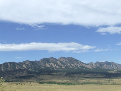
The Flatirons, the mountain range which Boulder is at the foot of.
So that's it folks, the end of the tour for now. Look here in the upcoming months for epic skiing pics from Alta, Utah and future adventures. Feel free to email me if you like, and check out the link to my online photo albums from the bike tour. There are many more pictures there that I haven't posted on my blog.
Subscribe to:
Posts (Atom)
